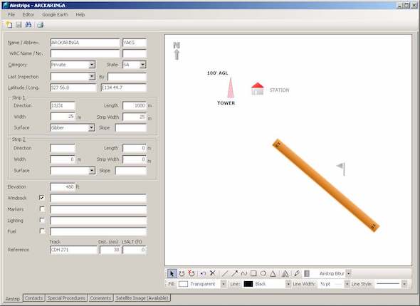
Airstrips
Create, draw and print airstrips not shown in ERSA.
- Record the airstrip's important details.
- Draw, rotate and scale your own or one of the predefined images, text and shapes.
- Airstrips comes packaged with a set of predefined image to help you get started quickly:
- Windsocks
- Windmills
- Telephone Poles
- Buildings
- Hangars
- Trees
- Hills
- Railroads
- Print them out and take them with you!
Click here to download an evaluation version.
Google Earth
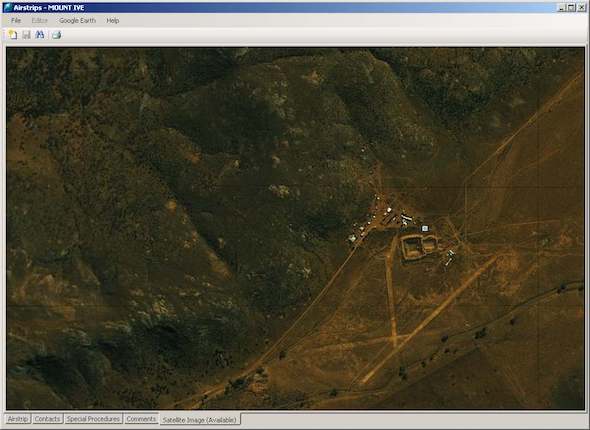
Integrates seamlessly with Google Earth allowing you to store and retrieve satellite photographs.